Sailboat Water in Tierra Verde, Treasure Island & St. Pete Beach: Who Actually Has It
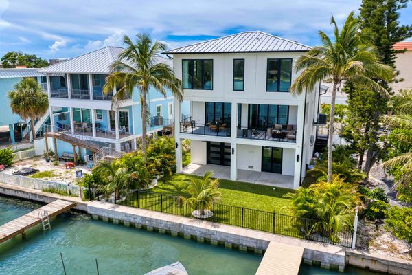
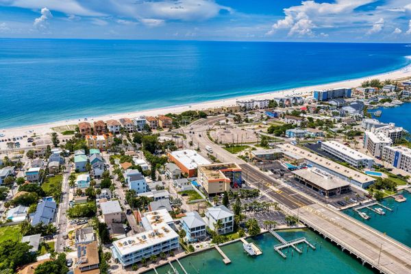
Every listing says "no fixed bridges." Almost none say which bridge. Here's who actually has a clear run to the Gulf, from someone who boats it.

About the Author
Carly Majorana
Waterfront and luxury real estate specialist at NextHome Gulf Coast in St. Petersburg, Florida. CLHMS Guild Member. Specializing in the technical side of waterfront — seawalls, boat lifts, bridge clearance, and flood zones. Serving buyers and sellers in St. Pete Beach, Tierra Verde, Treasure Island, St. Petersburg, Bayway Isles, and Pinellas Point.
Every waterfront listing on the beaches says one of three things. "Deep water." "Sailboat water." "No fixed bridges."
Almost none of them say which bridge.
That matters, because between the canal behind your house and the Gulf there are about a dozen bridges, and they are not the same. Some are 65 feet and you'll never think about them. Some open on a schedule and you'll plan your Saturday around them. One of them is 5 feet.
I live on Treasure Island and I boat out of it, so here's the version of this I'd tell a friend. No chart reading required.
Fair warning on the numbers. The bridge heights below come from the Coast Guard and NOAA and they're reliable, because bridges don't move. The water depths are another story. Nobody surveys the residential canals, and the passes get dredged and fill back in on a cycle, so most published depth figures are somebody's guess from an unknown year. Where I give a depth, it's what I've seen from my own boat.
Tierra Verde is the real one
If you want actual sailboat water on the beaches, this is it, and it's a recent thing.
Both Pinellas Bayway bridges between Tierra Verde and open water used to be drawbridges. They opened on the hour and half hour and everyone hated them. The one toward St. Pete Beach was replaced with a fixed 65-foot span in 2013 and 2014. The one over the Intracoastal went fixed at 65 feet in February 2021. So as of a few years ago, there is no drawbridge between Tierra Verde and the Gulf. None. You leave your dock, you go.
The one low bridge in the neighborhood is the toll bridge south to Fort De Soto, which is fixed at 20 feet over Bunces Pass. That only matters if you're heading out through Bunces, and if you're heading out through Bunces at night you have bigger questions than the bridge.
The county also dredged the Grand Canal entrance in 2024, to around 11 feet, which was the first time it had been touched since the neighborhood was built in the sixties. The canal was quietly filling in with sand from Shell Key and residents fought for years over who was going to pay the two million dollars. They won, it got dredged, and it'll need it again eventually. Worth knowing if you're buying on the Grand Canal.
One asterisk: Pine Key sits behind its own little bridge on Madonna Blvd, and the county is replacing that bridge starting late 2026. If you're looking on Pine Key with a hardtop or a tower, go stand under it first.
Verdict: sailboat water, no asterisk. The only neighborhood on this list I'd say that about.
Pass-a-Grille and Vina del Mar, mostly
Out the Pass-a-Grille channel and under the 65-foot Bayway span and you're in the Gulf. For the channel side of Vina del Mar and the Pass-a-Grille back channel, "no fixed bridges" is a fair thing to put in a listing.
The catch is the little bridge at 21st Ave that connects Vina del Mar to Pass-a-Grille. It's fixed, it's been there since the fifties, and nobody publishes a clearance for it. Docks on the inside of that bridge are a different product than docks on the outside. Same neighborhood, same listing language, different boat.
Also, the Army Corps is dredging Pass-a-Grille Pass in 2027. That's good news, and also a sign it needs it.
Verdict: sailboat water on the channel side. Ask which side of the 21st Ave bridge before you get attached.
St. Pete Beach bayside: yes, with a schedule
Belle Vista, Bahia Shores, Boca Ciega Isle, the Brightwater area. All on Boca Ciega Bay. To reach the Gulf you either go south under the 65-foot Bayway, or north through Johns Pass (a drawbridge that opens whenever you ask) or the Corey Causeway (a drawbridge that opens on the hour, :20 and :40 during the day).
So there's no low fixed bridge in your way. There's also no "just go." A sailboat here works fine, it just has a drawbridge in its life.
There's an old Belle Vista listing still floating around online that says "deep, calm sailboat water" in the description and "Bridges - Fixed" in the MLS data field. Both true. That's this whole post in one listing.
Verdict: great powerboat water. Sailboat water with a calendar.
Treasure Island's isles, and the 5-foot bridge
Isle of Capri, Isle of Palms, Paradise Island. Protected canals, Johns Pass ten minutes away, and Johns Pass opens on demand, so its 28-foot closed clearance mostly doesn't matter. The Treasure Island Causeway is 21 feet closed and opens every 20 minutes during the day. Powerboats don't notice any of this. Sailboats time it.
Here's the one nobody mentions. The Treasure Island Causeway isn't just the drawbridge. It's also two fixed spans on either end, and per NOAA they are 4 feet and 5 feet. The 5-foot one is the west span, between Paradise Island and Treasure Island proper. Whether a given dock has to pass under it depends on which canal it's on, and that's not something a listing will tell you. A dock stuck behind a 5-foot bridge is a kayak dock. It will still be marketed as waterfront. It will still have a lift. The lift will be decorative.
Verdict: excellent powerboat water. On Paradise Island, check the route from the dock to open water before anything else. Not the house. The dock.
Sunset Beach: two islands in one
The south end of Treasure Island, and the part I get asked about most.
The bayside canals drain into Boca Ciega and behave like the isles above. Fine boat water, Johns Pass or the causeway to get out.
The Blind Pass side is where the paper and the water disagree. On paper, the Gulf Blvd bridge over the pass is fixed at 11 feet, NOAA calls the pass "shallow," and nobody maintains it as a channel. The Corps digs it out every four or five years, mostly because they want the sand for the beach, and it fills back in.
In real life, I take a 30-foot center console with a tower under that bridge and out that pass constantly, at every tide, and it has never once been a problem. Not the bridge, not the depth. So it is not the wall the numbers make it sound like. It's also a center console that draws a couple of feet, not a sailboat with a mast and a keel. Bring one of those and we're having a different conversation.
Verdict: real boat water on both sides, for the right boat. Know your own air draft and draft before you buy on the pass side, because the listing won't tell you and the chart is guessing.
The two-foot rule
One number worth keeping. Around here the difference between an average low tide and an average high tide is about two feet. Bridge clearances are published at high tide (the worst case), and chart depths are published at low tide (also the worst case). So a "21-foot" bridge has about 23 feet at low tide, and "4 feet of water" is about 6 at high. A hard north wind in winter can take another foot off a low tide, and it does.
What I actually check
Before you write an offer on any of these, I want to know which side of every fixed bridge the dock is on, what boat the seller kept there and whether it ever touched bottom, and whether the canal has ever been dredged and who paid. Then I want to see the lift's rated capacity next to your boat's weight, because the depth question and the lift question always show up together. None of this is on the listing. All of it changes the price.
FAQ
Is Tierra Verde sailboat water?
Yes. Both Pinellas Bayway bridges between Tierra Verde and open water are fixed at 65 feet (replaced in 2013–14 and 2021). There's no drawbridge. The Fort De Soto bridge over Bunces Pass is fixed at 20 feet, and Pine Key sits behind the Madonna Blvd bridge.
Does Treasure Island have fixed bridges?
The Treasure Island Causeway drawbridge is 21 feet closed and opens on a schedule. Its two fixed end spans are 4 and 5 feet. Blind Pass on the south end has an 11-foot fixed bridge. Johns Pass is a drawbridge that opens on demand.
How high is the Johns Pass bridge?
28 feet at high tide when closed, and it opens on request 24 hours a day on VHF channel 9.
Can you get to the Gulf from Sunset Beach without going under a bridge?
Only from docks already on the Gulf side of the Blind Pass bridge, which is fixed at 11 feet on paper. A 30-foot center console with a tower clears it at every tide in my experience. Blind Pass isn't a maintained channel, so check it for your own boat. Everyone else goes out Johns Pass or the causeway.
Is St. Pete Beach sailboat water?
Belle Vista, Bahia Shores and the bayside neighborhoods can reach the Gulf with no low fixed bridges, but the routes go under a 65-foot span or through drawbridges (Corey Causeway on a schedule, Johns Pass on demand). Pass-a-Grille and the channel side of Vina del Mar have the cleanest run.